Embark on an enlightening journey with our “World & Continents Maps Set,” a comprehensive collection of 19 captivating pages meticulously crafted to enrich geography lessons for learners of all ages. This engaging package features a variety of activities to deepen comprehension, transforming the study of the world into an interactive and immersive experience.
Discover What’s Inside:
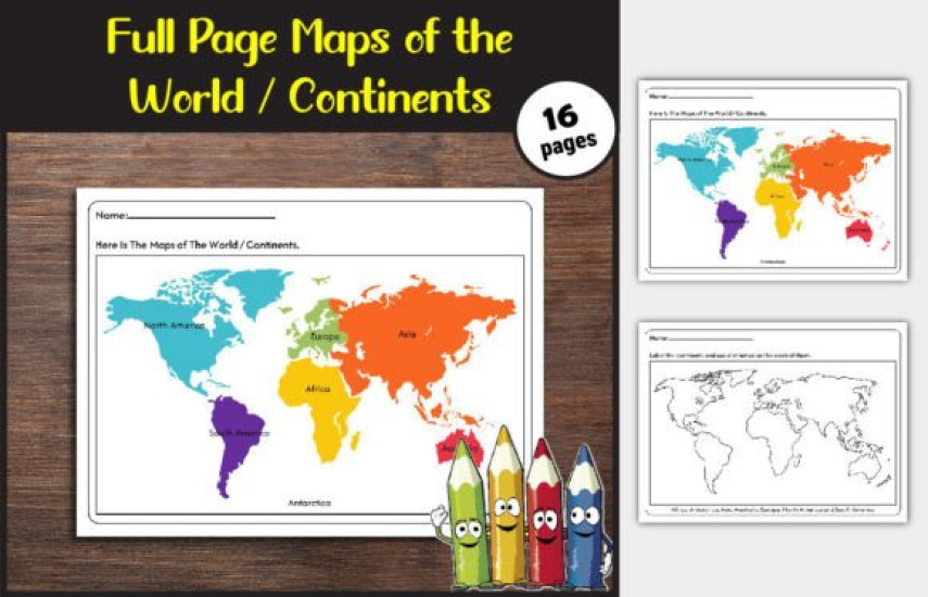
Color the Continents: Unleash creativity as students breathe life into the world by coloring each continent.
Label the Continents: Cultivate geographical knowledge by pinpointing continents on blank maps.
Individual Continent Maps: Delve into regional insights with dedicated maps for Africa, Antarctica, Asia, Australia, Europe, North America, South America, and the United States.
Labeled & Plain Versions: Tailoring to diverse learning styles, each map offers labeled and plain versions, providing adaptability in lesson planning.
Perfect for:
Classroom activities
Homeschooling lessons
Geography curriculum enrichment
Engaging and interactive learning
⋆ SPECIFICATION:
✓ Page Size: 8.5×11
✓ High-Quality Print Ready.
✓ Dimensions: (8.5 x 11 inches).
✓ Format: PDF + JPG + PNG
✓ Pages: 17 Pages
✓ Bleed Setting: No Bleed
Our “Explore & Learn” resource extends beyond mere maps; it serves as a portal to global awareness. Ignite curiosity, inspire exploration, and witness students develop a profound understanding of the world and its diverse continents.
Need support? Throw us an email at contact@spt.com we're always glad to help you 🙂
No Reviews
Last Update
May 23, 2026 - 07:10 AM
High Resolution
No
Category
Resource Type
Release Date
May 23, 2026 - 07:10 AM
 English